Forest Monitoring in Near Real-Time
by
ICEYE
Case Study Analysis
This application study was conducted during July 22nd 2021 to September 4th 2021 in Acre, Brazil. The Amazon rainforest covers an area of 6,000,000 km2 and it is prone to illegal deforestation that effects the ecosystem, contributes to global warming and effects the economy.
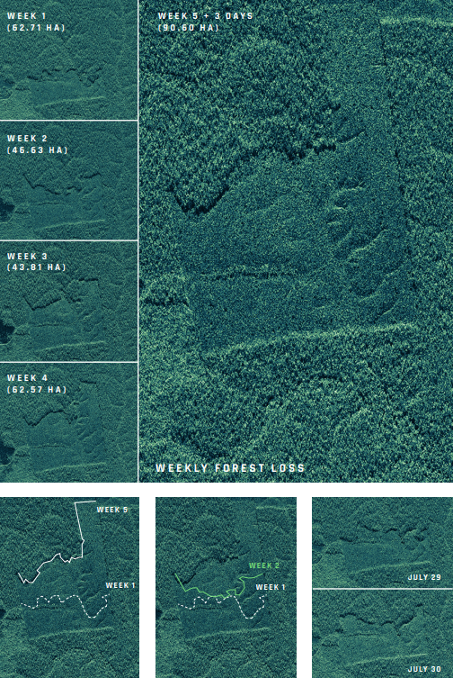
Source: 'Deforestation Monitoring', ICEYE (https://www.iceye.com/sar-data/use-cases/deforestation-monitoring#form)
A Different Way to Monitor Forests
The above ICEYE analysis depicts the progression of deforestation in the Amazon rainforest over the span of 44 days. Since forests are often hidden by clouds and fog, SAR data due to its ability to penetrate through clouds it is rendered the perfect candidate for this task.
ICEYE's SAR micro-satellites enabled the detection of change in forest structure caused by deforestation & the tracking & measuring of its progression over the span of six weeks. The acquisition mode that was used for this analysis was Strip Mode, which is perfect for frequent & detailed monitoring of vast land areas in very high resolution.
ICEYE SAR Data Can:
- Detection of deforestation & progression track
- Identification of illegal constructions
- Reveal illegal mining sites
- Uncovering hidden roads and airstrips
- Monitoring sustainable development of plantations