ICEYE
ICEYE is a Finnish company that operates a growing constellation of small, commercial Synthetic Aperture Radar (SAR) satellites. The first satellite, ICEYE-X1, was launched in 2018 as a technology demonstrator. Since then, ICEYE has rapidly expanded its fleet, providing high-resolution SAR imagery with frequent revisit times, making near real-time monitoring possible.
ICEYE satellites primarily operate in the X-band, capturing images in all-weather, day-and-night conditions. Their applications include maritime monitoring, environmental monitoring, infrastructure management & disaster response (earthquakes, floods etc.).
ICEYE is notable for leveraging small satellite technology to reduce costs & increase agility compared to traditional SAR satellites, enabling rapid tasking & more flexible data access both commercial & government clients.
ICEYE-X1
ICEYE-X1 was the launched in January 2018 and it was the world's first SAR satellite under 100 kg and was instrumental in demonstrating the technical feasibility of achieving high-resolution SAR imaging using a small satellite platform, paving the way for commercial operations.
Its mission included monitoring the sea ice for maritime and environmental use, it monitored and tracked oil spills and it aided in the prevention of illegal fishing.
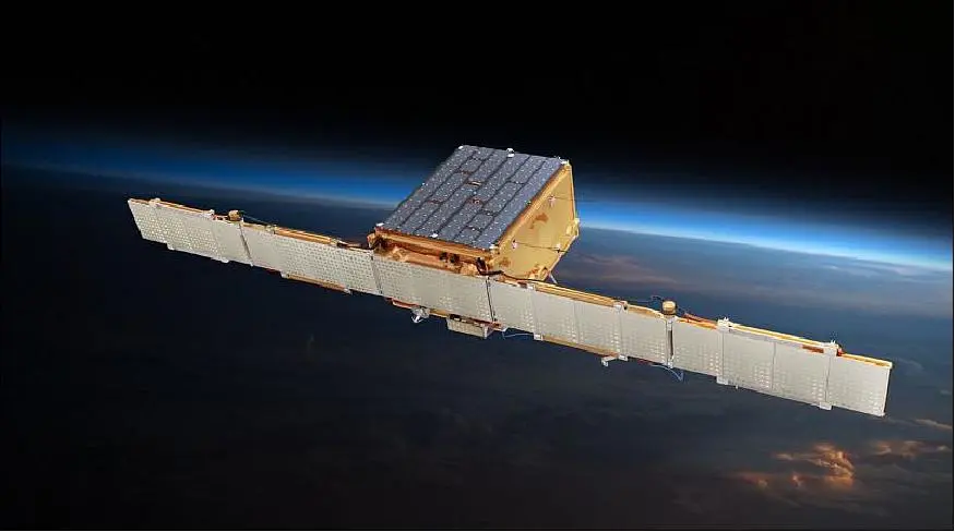
Source: "ICEYE - X1 (SAR Microsatellite-X1", eoPortal (https://www.eoportal.org/satellite-missions/iceye-x1#overview)
Generation 2 (Gen 2)
In the late 2019 ICEYE launched its Generation 2 (Gen 2) satellites forming the initial operational constellation starting in the late 2018. These satellites established the commercial SAR data service, providing standard imaging modes like Spot (high resolution) & Strip (Wide area Monitoring). The Gen 2 satellites were defined by a maximum ground resolution of 1 meter and used a pulse bandwidth of 300 MHz, with data downlink speeds reaching up to 500 Mbps.
The capabilities of Gen 2 made them ideal for monitoring rapid, time-critical changes on Earth such as disaster & natural catastrophe response such as flood mapping in near-real time to aid rescue efforts, damaged assessment and for the support of insurance claims. The above category also included wildfire and hurricane damage for the assessment of property damage immediately after the event and infrastructure monitoring that focused on critical infrastructure such as bridges, dams and pipelines for stability damage.
The 2nd Gen satellites also monitored Maritime & Security and they detected vessels under maritime domain awareness, focusing on suspicious activities like illegal fishing & tracking ship movements. They also identified & tracked oil-spill detection on the surface of the sea and lastly sea ice was monitored and tracked in order to see its movement and to detect large icebergs.
Land use was another mission Gen 2 satellites had since their ability to acquire images from the same exact location allowed for extremely sensitive monitoring. Firstly, in this category, Strategic Site Monitoring was one of the mission, this focused on observing military bases, construction sites & ports for detection of subtle changes in vehicle concentrations or construction progress. Another important matter was Deforestation, they monitored remote forest areas to quickly identify and track illegal logging. Lastly, Ground movement using interferometry was achieved and it detected ground deformation at millimeter level related to construction, geological hazards and mining.
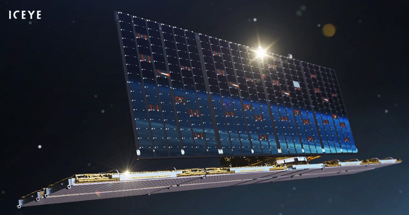
Source: "Figure 1: ICEYE Generation 2 Satellite", The ICEYE Fleet - ICEYE Product Documentation 5.0 (https://sar.iceye.com/5.0/productguide/fleet/)
Generation 3 (Gen 3)
Generation 3 satellites began deployment around 2023 and this gen brought significant improvements in image quality and resolution. The bandwidth doubled to 600 MHz, enabling the introduction of the Spot Fine imaging mode, which achieves a ground resolution of 0.5 meters or coarser The Gen 3 satellites also integrated a steerable antenna for the X-band downlink, maintaining speeds up to 500 Mbps while adding greater agility. A subsequent iteration, known as Gen 3.5, further expanded the horizons, achieving resolutions of 0.25 meters or coarser by doubling the pulse bandwidth again up to 1200 MHz. This rapid, constant enhancement focused on increasing the information density & precision of the imagery.
The Gen 3 satellites mission is focused on 3 main aspects. First is the Maritime Domain Awareness, the 50 cm resolution allowed for analysts to determine the structural characteristics (shape, size etc.) of individual shops, helping distinguish different types of vessels. Second is the National Security & Defense, this was used for monitoring critical infrastructure, military bases and border areas for the detection of subtle changes, track the movement of vehicles or characterize specific equipment. Third is the Natural Catastrophe Response, this is a High-Confidence Damage Assessment, the finer resolution enables more precise mapping of damage zones after floods, hurricanes, fires, aiding insurance claims and recovery efforts with higher accuracy. Fourth is the change detection that provides ground stability in millimeter level, this takes advantage of the coherent nature of SAR data allowing for sensitive detection of ground movement through interferometric analysis caused by sinkholes or geological shifts such as faults.
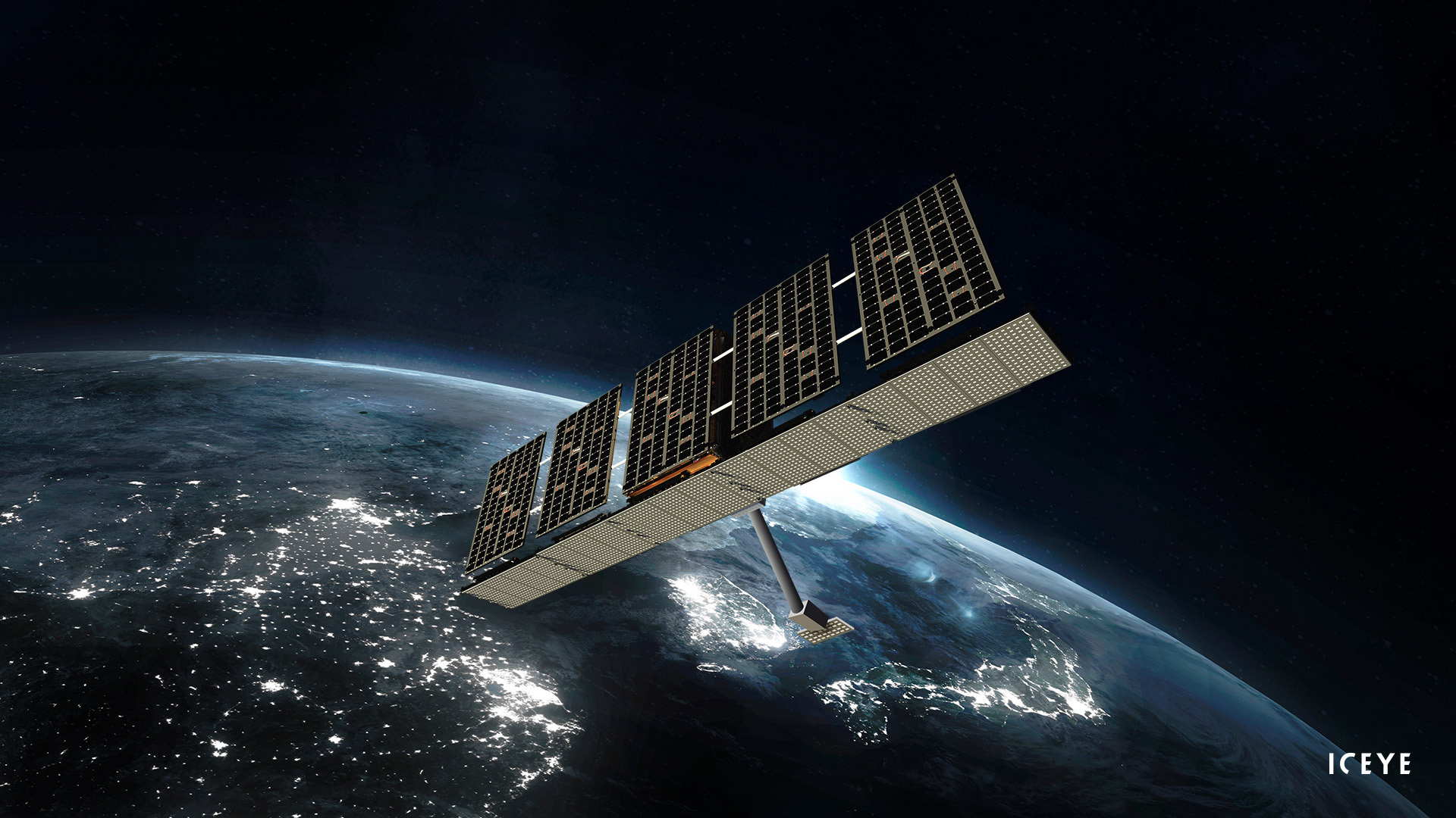
Source: "Figure 1: ICEYE Generation 3 Satellite", The ICEYE Fleet - ICEYE Product Documentation 5.2.7 (https://sar.iceye.com/5.2.7/productguide/fleet/)
Generation 4 (Gen 4)
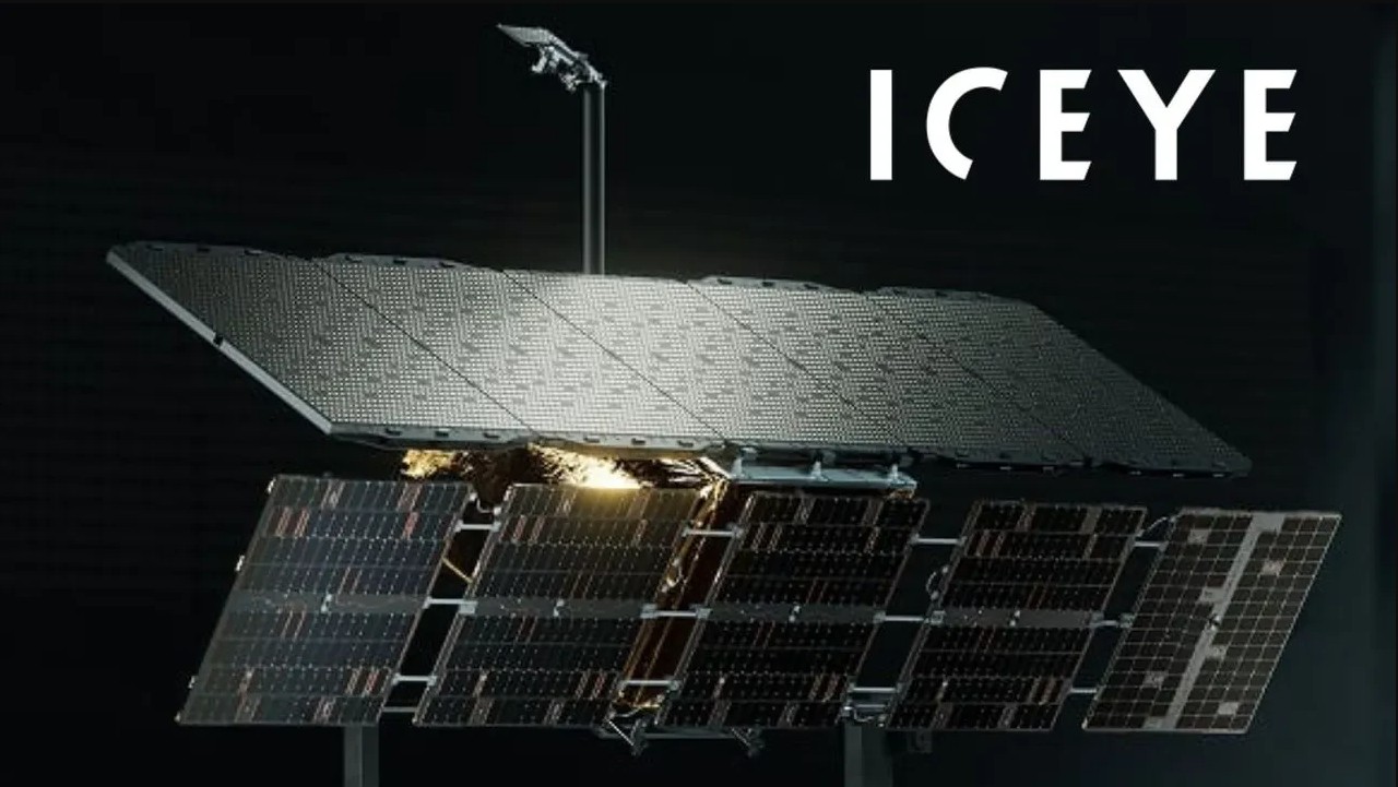
The Generation 4 (Gen 4) satellite got introduced in 2025. Designed specifically for high-demand defense and Intelligence, Surveillance and Reconnaissance (ISR) applications, Gen 4 satellites offer unmatched performance. The resolution capability has been pushed to up to 16 centimeters, accompanied by a 1200 MHz imaging bandwidth. The Gen 4 design features doubled signal strength and antenna size compared to the earlier generations, leading to a 250% leap in high-resolution imaging coverage. This generation significantly boosts the data link speed, reaching up to 700 Mbps with its steerable antenna and provides exceptionally agility, capable of taking 15+ images per acquisition. Collectively, the ICEYE constellation, leveraging these generations, achieves a sub-15 minute revest time for any location on Earth.
The Generation 4 satellites have 4 missions. The first one is focused on Defense & Intelligence because of their enhanced resolution they can identify specific aircraft and vehicle models along with temporary structures, further supporting intelligence, surveillance and reconnaissance missions worldwide. The second one is the Maritime Domain Awareness which targets covert vessel detection. This is succeeded through the rapid and precise detection and classification of vessels with transporters turned off that are involved in covert operations, smuggling, or illegal fishing with greater than 90% accuracy. The third mission revolves around National Security & Border Monitoring, Wide-Area Surveillance which monitors long borders and critical strategic sites such as ports, military bases, launch sites in single pass to track subtle changes or suspicious cross-border activity. The last mission is about Natural Catastrophe Resilience which provides immediate, high-fidelity damage assessment by acquiring clearer images post-disaster (hurricane, floods, fires) that allow insurance, government and rescue teams to assess damage with highest level of detail available.
Source: "ICEYE Successfully Launches World’s First SAR Microsatellite and Establishes Finland’s First Commercial Satellite Operations", ICEYE Press (https://www.iceye.com/newsroom/press-releases/iceye-launches-high-performance-gen4-satellite-for-commercial-operations)