What is Synthetic Aperture Radar?
Synthetic Aperture Radar or SAR is a type of radar technology used to create highly detailed images of the Earth's surface regardless of daylight or weather conditions. Compared to optical sensors, which rely on clear skies and sunlight, SAR systems actively send out microwave signals and then record the reflections that bounce back from the ground. At it's core SAR provides all weather, day-and-night imaging, high resolution detail and surface information beyond what the eye sees including texture, moisture levels and movements. All the above make SAR a powerful tool because it operates without any environmental restrictions.
More DetailsSAR Uses & Applications
Earth Observation & Environmental Monitoring, Disaster & Risk Management, Urban & Infrastructure Monitoring, Climate & Cryosphere Studies, Ocean & Marine Applications, Defense & Security, Geology & Mining, Science & Research
More DetailsICEYE Satellites & Their Missions
Meet the SAR satellites & their missions that collect SAR data from space & see how they help us monitor Earth's surface
From Data to Insight
Discover the toolkits that turn SAR signals into actionable information
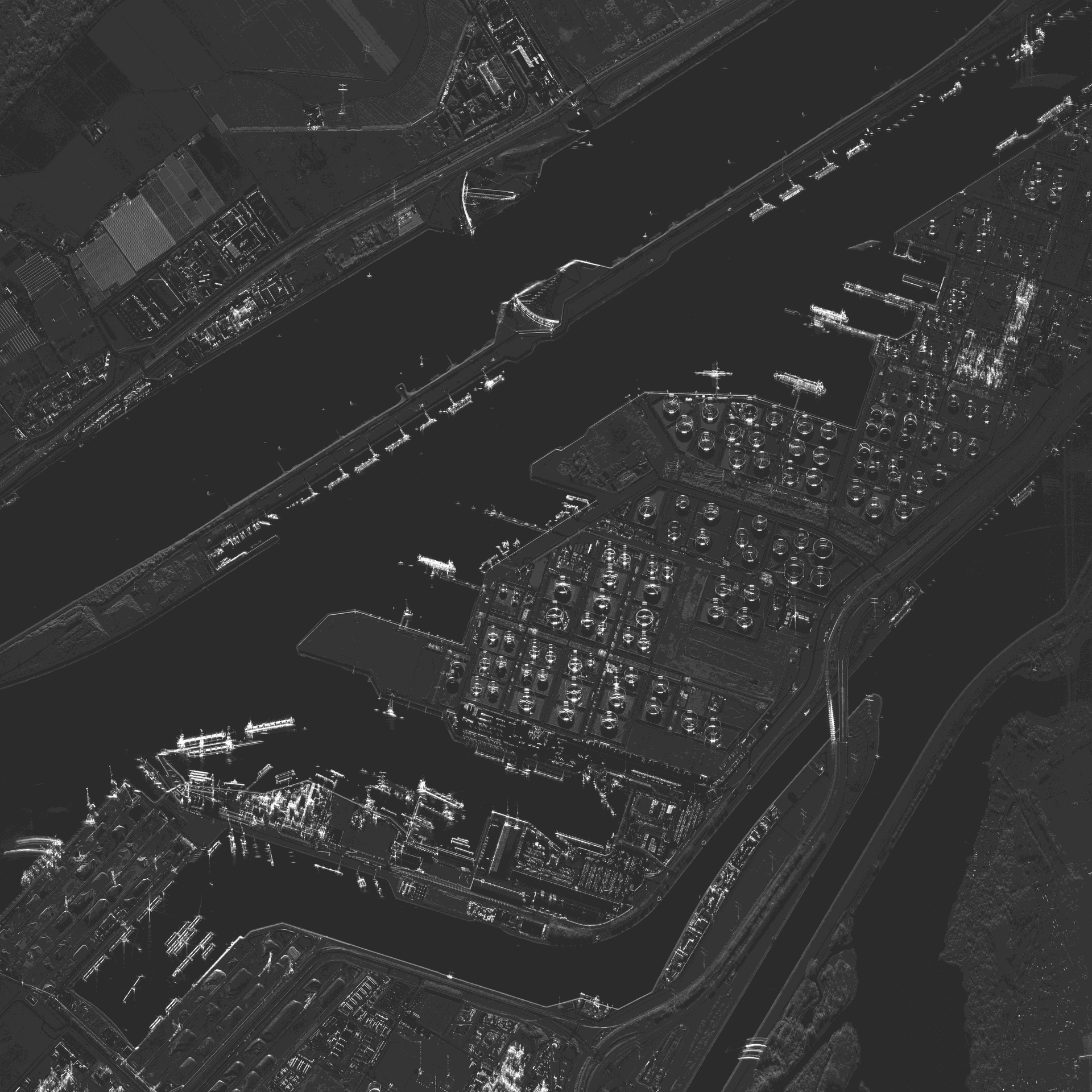
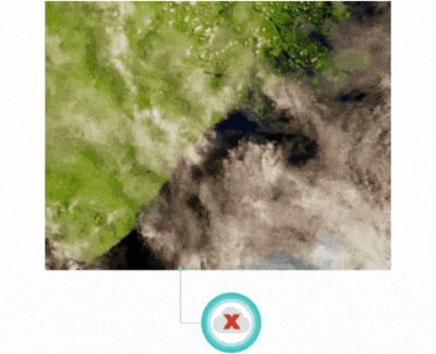
Optical Image vs SAR Image
In the optical image, Balikpapan Bay in Indonesia is covered in clouds & it is not visible. The SAR image is showing detailed data from Balikpapan Bay since SAR technology can penetrate through clouds.
Source: Introduction to Synthetic Aperture Radar,” ArcGIS Blog — Imagery & Remote Sensing (https://www.esri.com/arcgis-blog/products/arcgis-pro/imagery/introduction-to-synthetic-aperture-radar)
Works Day & Night
SAR does not need sunlight

All Weather Vision
SAR can see through clouds, fog & smoke - ideal for monitoring floods & storms
Super Precise
SAR can detect ground movement as small as a few millimeters

Farming From Space
Farmers use SAR to track crop growth, soil moisture, & irrigation efficiency

Urban Insights
SAR helps track city growth, infrastructure ability & even building subsidence
Orbiting Eyes
SAR satellites circle the Earth hundreds of times per day